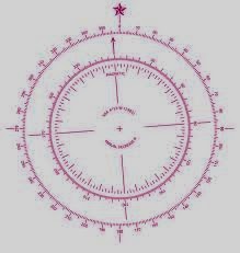
The chart's compass rose.
Illus. credit: Google Images
To understand everything on a chart, you want to get a copy of Chart No. 1, which is not a chart at all, but a catalog of all the symbols used on any US charts. They used to be free, but free has gone the way of the dodo bird. NOAA no longer prints Chart 1, but at the following link, you may download a PDF of Chart No. 1 or purchase a commercially printed copy from one of NOAA’s licensed chart printers. They are listed there also.http://www.nauticalcharts.noaa.gov/mcd/chartno1.htm
http://www.nauticalcharts.noaa.gov/mcd/chartno1.htm
At this second link, you can obtain a catalog of all the charts available for the area you may be interested in, or view the chart on-line to make sure it’s the one you want. You may then contact one of the authorized printers to obtain a copy of a POD chart. A POD, or ‘print on demand’ chart is not printed until it is ordered. The advantage is that the chart is printed with all the corrections and updates available at the time of the printing, and is usually available for shipping within a couple days. If you look in the left margin of the site, you’ll see a tab for finding paper charts.
A number of sources will print small craft charts, which are of particular use for paddlers, especially the ones that are spiral bound. Among those, you will also find charts that are laminated, waterproof, or water resistant. I have included a link to one such supplier, not as a recommendation for that business, but so you can see what is available.http://www.waterproofcharts.com/maine-boston-charts-maps-nav.htm
http://www.landfallnavigation.com/bookscruiseinland.html
If you are using paper charts, there are a couple things you can do to protect them from water damage. One is taking them to an office supplier and having them film laminated. The second is carrying them in a map/chart case. Third, you can apply a sealer yourself, such as the Map Seal Waterproofing sold by Campmor. It is a water-based polymer film you just brush on. Cliff Jacobson has another suggestion, which I haven’t tried. He brushes his charts and maps with Thompson Water Seal as a less expensive alternative to the other options.
A number of other chart suppliers you can search are Richardson Maptech, Imray-Iolaire, Canadian Hydrographic, and British Admiralty. There are also major navigation supply houses that can fit you out with any chart you may want from anywhere in the world. All you have to do is ask. Three are Maryland Nautical, Bluewater Books and Charts, and Landfall Navigation.http://mdnautical.com/655-captain-segull-s-nautical-sportfishing-charts
http://www.bluewaterweb.com/Default.aspx
http://www.landfallnavigation.com/charts.html
If you find this topic of interest, Amazon lists 2,793 books on both land and coastal navigation. If you want to really go academic on the topic of navigation, the ultimate resources are:
No.9, The American Practical Navigator by Nathaniel Bowditch, commonly just referred to as Bowditch.
Dutton’s Nautical Navigation, 15th Edition, by Thomas J. Cutler
Marine Navigation: Piloting and Celestial and Electronic Navigation by Richard R. Hobbs.
Bowditch is the navigational bible, and was likely the main source for the writing of the other 2,792 navigation books. The latter two were written as navigation textbooks for the U.S. Naval Academy. Some reviewers prefer Dutton over Hobbs for greater clarity.
No comments:
Post a Comment